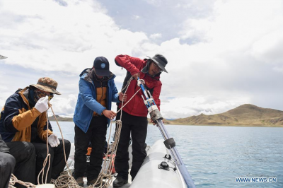
July 26, 2019 -- Photo taken on July 22, 2019 shows scientists take out sediment core. (Xinhua/Jigme Dorje)
 July 26, 2019 -- Photo taken on July 22, 2019 shows Chen Hao detects underwater topography using sonar instrument. (Xinhua/Jigme Dorje)  July 26, 2019 -- Photo taken on July 22, 2019 shows scientists put a gravity drill into water to get sediment core. (Xinhua/Jigme Dorje)  July 26, 2019 -- Aerial photo taken on July 22, 2019 shows scientists head for the main area of the lake by boat. (Xinhua/Jigme Dorje)  July 26, 2019 -- Photo taken on July 22, 2019 shows scientists use navigation system. (Xinhua/Jigme Dorje) July 26, 2019 -- Chinese scientists have been conducting surveys to measure the depth of Yamdrok Lake, one of the three sacred lakes in southwest China’s Tibet Autonomous Region.
This is the first time that Chinese scientists have taken a complete depth measurement of the lake.
The surveys are part of China’s second round of comprehensive scientific research on the Qinghai-Tibet Plateau.
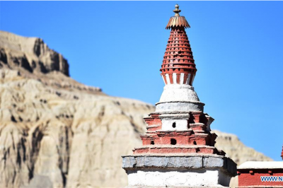
Located in Nagarze County of Shannan Prefecture, Tibet, Yamdrok Lake is less than 100 km from the capital city of Lhasa. With its picturesque scenery, the lake is one of Tibet’s most popular tourism attractions.
By:Gao Jingna
|
- Home
- News Tibet |Exclusive |China |World |Other Tibetan-Inhabited Area |Tibet through the Eyes of Foreigners |Related News
- Documents White Papers |Others
- Photo Politics |Economy & Society |Culture & Religion |Human & Nature |Beautiful Tibet |Other Tibetan-Inhabited Area |Exchanges |Related
- Video News |Documentary |Micro-Video |Entertainment
- Art
- Tourism
- In Focus
- About Tibet